It's February, 2020. Cold and damp weather prevails.
My friend Chris sends me a text, asking if I'd like to join him hiking the GR131 across Gran Canaria at the end of the month. After a touch of Googling I agree.
The route is described in Paddy Dillon's "Walking in Gran Canaria". Technically it crosses each of the Canary Isles (Chris hiked across Tenerife last year) but, on Gran Canaria it's not yet waymarked as the GR131, rather it's a series of linked, local routes which ARE waymarked. It's about 56 miles.
Chris has found a GPX track online and, having bought a hiking map to use on Viewranger, I soon have the track visible. I also, for completeness, buy a paper/plastic version of the same map, see
here.
We fly out on 20th February with Jet2.com, leaving on a cold but dry morning from Manchester. Four and a half hours later we land in the warmth of Las Palmas airport and a bus takes us into the city and a pleasant Airbnb apartment in the suburbs. We wander out for pizza and beer before retiring.
In the morning, a half hour walk sees us onto the 8am bus to Puerto de las Nieves. It's a beautiful morning as the sun rises over bustling Las Palmas.
In Puerto de las Nieves we enjoy coffee and croissants in a cafe then set off, at around 10am, on our hike. Our route will take us 6 days, with 5 nights camping in the wilds. Wild camping is, technically, illegal but, anecdotally, folk do it anyway. Chris stocks up on food before we depart.
After a short road walk out of the small town we pick up a zig-zagging, stony trail uphill. It's around 23C but there's a slight breeze coming in off the sea. We're told there's no running water in the wilds, all of the drinking water coming from desalination plants. Hence, we're carrying 2 litres of water each. It's also not easy to buy gas for stoves on Gran Canaria so we bought meths from a hardware store in Las Palmas and I bought a mini Trangia stove especially for the trip.
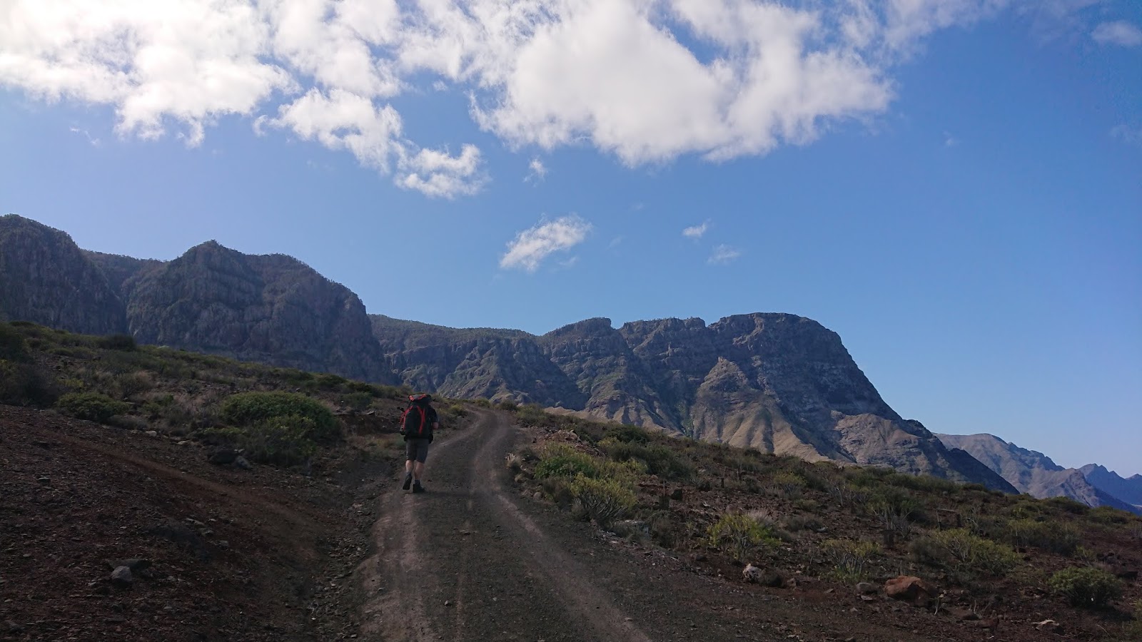
Today's route is around 7 miles but involves around 1250m of ascent. The first 600m are straightforward. Lots of switchbacks with easy gradients.
After a couple of miles our route strikes away from the broad track and begins traversing steep, open slopes. I find the exposure a little unnerving so take no photos. This vertiginous section is noted in our guide book. Chris encourages me along, kindly.
After a mile or so of this traversing, our route turns and becomes a very steep, but wider track as it tackles the further 600m or so of ascent. The gradient is ferocious. As commonly happens, this photo doesn't adequately portray the steepness.
We crest the hill after almost 6 hours of climbing (including breaks) and enter a forest, where the trail undulates at an easier angle.
Shortly before our stop for the night we pass a couple of reservoirs, which I'd spotted in my planning. Chris goes to take a closer look.
And, eventually, we emerge onto a track, which takes us to a picnic area (there's a road up to here). Further on there's one of a series of free, forest campgrounds with toilets and water. Provided you obtain a free permit, you can use these, but my research revealed this one, at Tamadaba, is closed due to a large wildfire here back in August 2019. There are, however, taps at the picnic area and a friend was here at Christmas and used these very taps, having driven up. But, when we arrive, the taps are shut off! Bugger!
Chris valiantly offers to walk back the half mile or so to the reservoir, with my water filter, preferring that I stay with our kit. We find a spot on a rise in the forest and make camp and Chris goes to fetch water. It's still, slightly cloudy and quite cool, so it's not long before I retreat to the warmth of my sleeping bag to prepare my dinner.
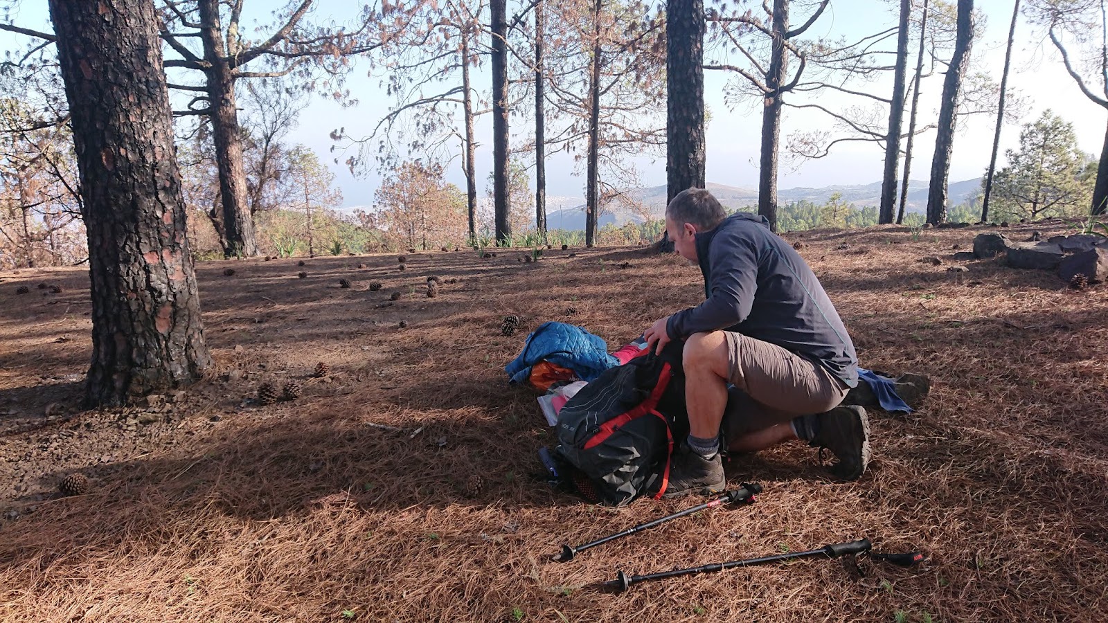
It's now Saturday 22nd February. A bright, beautiful, mild morning up here, high in the forest.
After a leisurely breakfast, we set out again. As Chris packs I notice how many of the trees are burnt around their trunks, to a height of maybe 1 metre or so. Clearly we're on the edge of last summer's wildfire.
The trail rises slowly through the forest and, ironically, we cross two thin streams, each of which we could easily have filtered water from. Oh well...
We've around 5 miles to walk today, before we arrive at the village of Artenara. Here, we can get water and we plan to resupply and, hopefully get a meal. We have another mile or so to walk after the village, to a planned wild camp. By eating in Artenara we'll need to carry less food and water.
It's a beautiful day for hiking. The sky is clear blue. It must be around 21C but there's a wonderful cooling breeze blowing, just enough to make the walking feel comfortable.
The trail parallels the road for a while, sometimes crossing from one side to the other. The occasional car passes, though not enough to intrude on our peace.
At a roadside viewpoint, a raven entertains us with its antics, bouncing in the breeze.
We leave the road for a stiff climb over the hill of Brezos at 1335 metres, before dropping down to a track which takes us into Artenara.
In the village we replenish our water at a tap then head off to find the only shop. It's around 2pm and the shop closes at 2:30. We buy supplies for the next couple of days. It's two days to the next shop. Then, we find a popular looking restaurant where we dine on a late lunch of rabbit stew, along with several drinks...
It's a little after 3 when we shoulder our packs again, now loaded with 4 litres of water each, to see us through the evening and into the next day. Oof!
We climb unbelievably steep steps through houses clinging to edge of the hill where Artenara sits. After a while we hit a pleasant, zig-zagging path again and, within an hour, we're at our chosen camp site. We wander around, seeking the best pitch, before settling on a small terrace, just hidden from the track below.
There's a noticeable breeze blowing as we pitch our tents but I manage to site my Thermarest camp chair just inside the door of my tent, out of the wind, as we settle down for an afternoon brew. My mini Trangia hasn't much of a windsheild though and runs out of meths before water for our brew has boiled. Chris makes an attempt with his stove, which has a better windshield, and manages to get the water to almost boiling. But it's enough for coffee, and some delicious cakes we'd bought in the shop.
We chew the fat, putting the world to rights and supping more coffee.
We have a good phone and data signal and Chrissie forwards me a message she's received from Norma Keohane. She and her husband John are experienced backpackers and multi TGO Challengers. They live, partly, on Tenerife, where they are right now. Norma knows where we are and is concerned. There's a calima on the way from Africa. I've never heard of a calima, but it seems it's a not uncommon phenomena hereabouts. A warm, powerful wind, carrying sand from the Sahara. It can last from 2-3 days, sometimes up to a week. Chris and I realise that this explains the sky, now dulled as you can see in the two pics above. The wind doesn't feel too bad though. We're in a bowl, providing a modicum of shelter.
Before retiring, I check the guys on my Hilleberg Enan. One of the main pole guys is secured around a large boulder, around 10 inches in diameter.
And so to bed...
It is probably the worst night I've ever spent in a tent. The wind howls and rattles the tent. It's warm though, and I strip off my sleeping kit and unzip my bag, using it as a quilt instead. Midnight passes before I finally put earplugs in and, eventually, drift off to sleep.
In the morning the wind is still howling and buffeting the tent, frequently flattening the sides.
I open the door on the fly and stick my head out. Both our tents look ok. I call out to Chris and we both remember a night we had in the Howgills a few years back. Interestingly I was in the Enan then too.
I attempt to boil water for coffee with the door open and just about manage it, by creating a windshield of boots and water containers, but it takes a lot of fuel. When it comes to a second brew I close the door, then worry about the flame licking around my pan, inside the porch...but I manage.
Having breakfasted I feel an urge and head out into the wind with my toilet kit. Digging a hole and managing to bag toilet paper is challenging. I'm almost blown over at least once.
Returning to the tent I switch on my phone. Chris and I both have messages telling us the calima has made the UK news. All the island airports are closed and the ferocity of the wind has led to locals being told to stay indoors. As Chris emerges and we begin to discuss options a gust of wind picks up his MSR Carbon Reflex 2 tent and throws it around 3 metres. We both dash to grab it. There are tears across the fly and inner, a snapped pole and guying points have been ripped off, leaving the pegs still in the ground.
We endeavour to ensure everything is secure inside what remains of the inner as Chris grabs his rucsac to begin packing.
I turn my attention to the Enan, which still stands firm. But the guy secured by the rock has come adrift and the other pole guy is frayed down by the peg. It's holding, but won't last much longer. I'm soon inside the tent, packing.
As I pack I'm considering options. I look at our guide book. We're at around 1400m. Four miles up the trail is a bus stop which can take us to Maspalomas, our intended end point at the south of the island. One mile back along the trail there are buses from Artenara down to Las Palmas. Ahead is a climb onto more exposed ground. Behind is a descent with known, mostly sheltered ground. We have one, one-person tent between us. I have a spare guy line to replace the damaged one. We could use it for two, without the inner, but it wouldn't be fun with winds like this blowing under the fly. And should we really be out in these conditions, with more height to gain and more exposure? I don't have my wind speed monitor with me, and it's hard estimating such things. It's all too easy to exaggerate. But, at best, I reckon winds through the night were around 40mph gusting to 50mph. At those speeds walking is difficult at best, dangerous at worst. My mind is made up.
With the Enan still standing I emerge. Chris is close to finishing packing and I begin, carefully, to take the tent down, ensuring firm pegs remain until it's flat. I'm also careful not to bend the solitary pole. I manage.
We have a brief discussion and it doesn't take much to get Chris to agree to my suggestion. We go back to Artenara and catch a bus. Chris walks up to a nearby ridge to see what it feels like. He can barely stand up there. But Chris wants to get some shelter and repack his bag. Fine. We drop into some trees, by a wall. There's shelter, of sorts. As Chris repacks his bag I check the internet again to see if buses are running (it's Sunday) and where to. As I watch, a gust picks up dry earth, 100m away and hurls it at us. We both shield our eyes against the onslaught.
And, as soon as we're able, we head off...back down the trail...into the wind. Waymarking signs have suffered.
It takes us about 40 minutes to get to Artenara. As we pass through the streets and houses there's debris everywhere. Here a pile of prickly pear leaves, there a tree branch, here broken roof tiles...
Chris retains his sense of humour.
As we enter the village I'm just considering coffee when I see folk standing at a bus stop. Chris suggests going straight there. He's right. A young backpacking couple, who passed our camp the previous evening, are there. They too had a difficult night in their tent. They tell us the bus to Las Palmas is due in 10 minutes.
Soon we're seated for a ride down precipitous mountain roads. It takes around an hour and a half. The driver is a hero. He makes good progress, slowing for each tight bend, always alert. He steers skilfully around downed trees and foliage. At one point a branch falls right across the road, only 10 metres ahead of us. He brakes, hard, then rolls safely over the thin branch and leaves.
Now we're back in Las Palmas. Lunching in surreal quiet in a park cafe on a stupendous sandwich, washed down with refreshing beers. Although it feels quite calm down here, the sky is brown.
I manage to book three nights in an Airbnb in Maspalomas, our last night there being already booked. And, after an hour long bus ride we're in the tourist resort, ensconced in a small, but comfortable apartment...reflecting.
For what it's worth, both tents are three season shelters. There's really no way we could have foreseen such a weather event. We heard it was, "the worst in years" and one person said he'd been in Maspalomas for three years and seen nothing like it.
And that's how our 6 day hike became 2 days.
We're neither of us beach holiday types, feeling like fish out of water down here amongst the sun-seekers. But we manage to amuse ourselves, spending one day walking east along the coast, one day west and the third exploring on rented bicycles.
Thankfully the airports opened again by Monday (I think) and most of the backlog was cleared by our booked flight on Thursday.
I'll leave with a few pics of Maspalomas life.
These ones are from Monday. The sky was still cloudy with sand but the worst was over. The guys spent all day vacuuming sand from the bottom of the pool. The bright blue shows the bit they'd cleaned.
These are from Tuesday as we walked across the Dunas de Maspalomas. The sky is noticeably clearer.
And by Wednesday, the effects of the storm had pretty much gone.
And there's a link to Chris's excellent YouTube video of the trip
here.
Another thread in life's tapestry eh?
Smile!